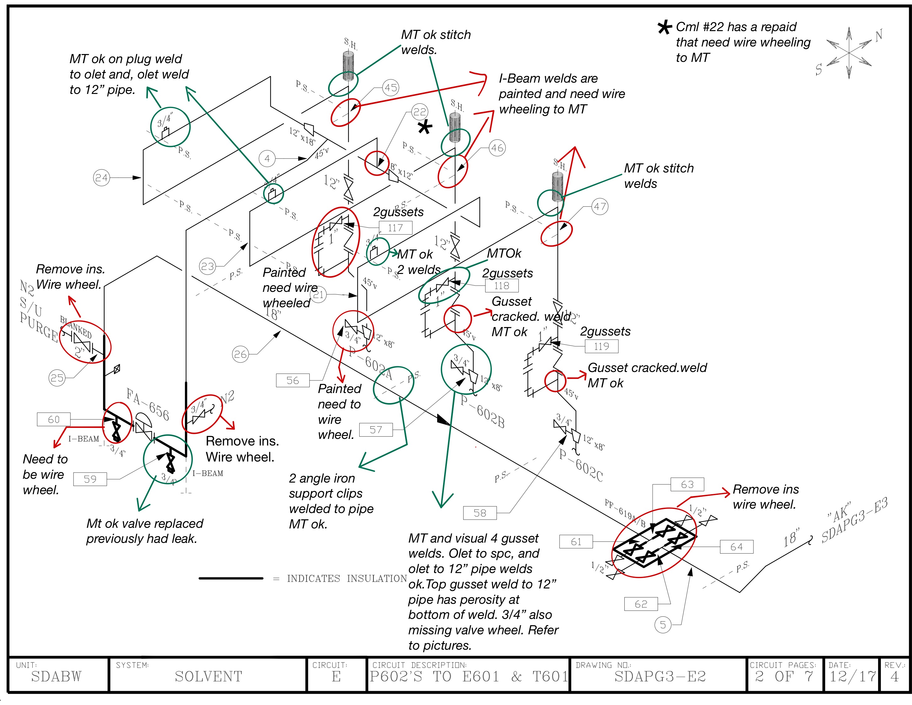
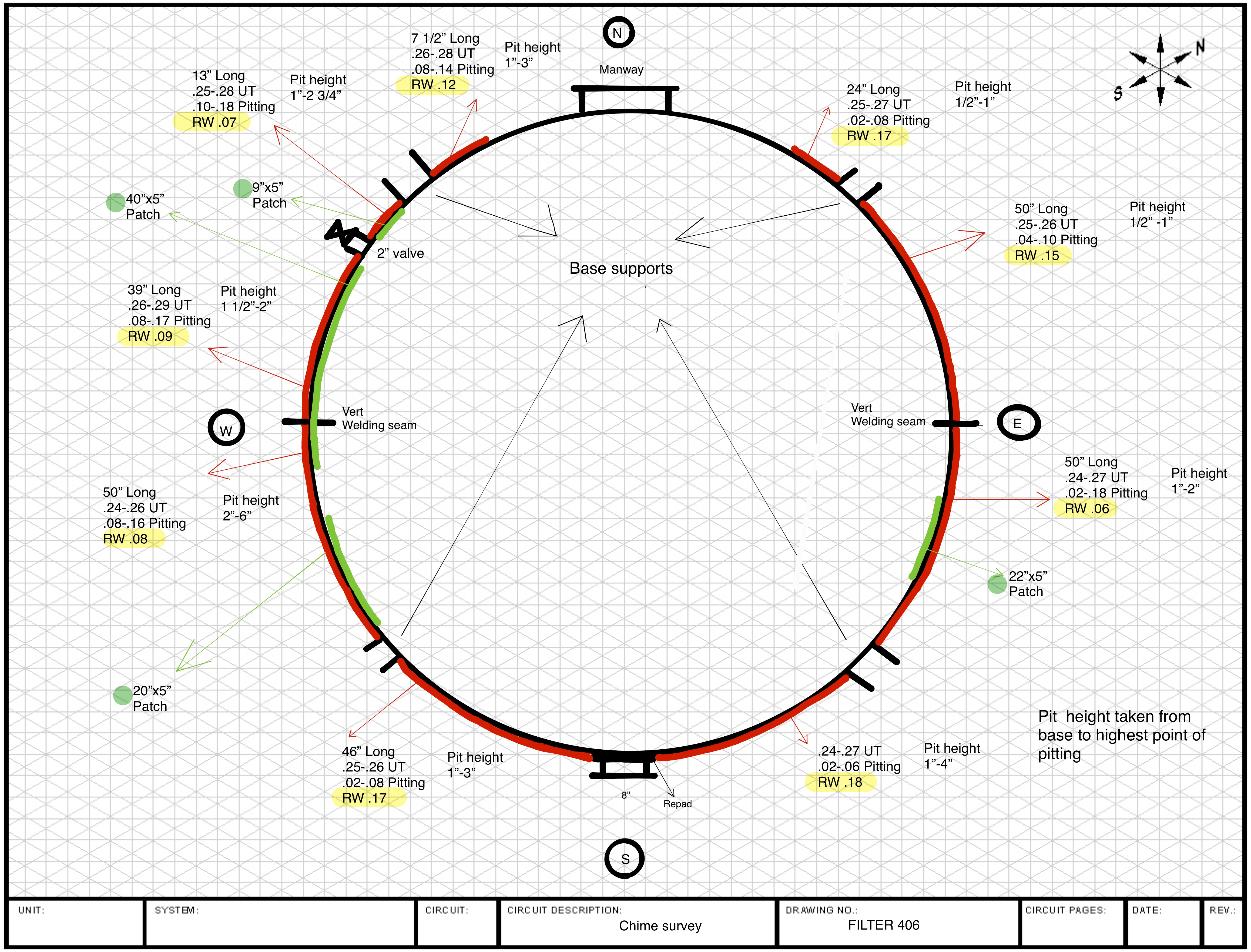
Technicians carry intrinsically safe tablets allowing them to generate reports digitally while in the field. Photos can be embedded into drawings and inspection iso’s and a complete package of preliminary data sent to the customer before the technician leaves the field. Clients that utilize commercial piping inspection software can integrate with the tablets to allow for direct wireless data entry.
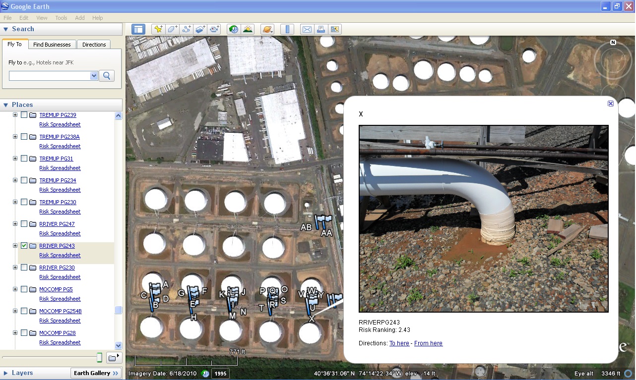
Portable GPS units can capture coordinates and photos to mark exact locations of piping components and equipment in the field. This data can be used to create waypoint overlays and plotted using Google Earth.


